Title: Carte de l'Isle-Grande et Coste de Bresil aux environs
Title: Carte de l'Isle-Grande et Coste de Bresil aux environs
[EM BRANCO]
Details
[EM BRANCO]
001SK00087.jpg
Martha e Erico Stickel
Brasiliana > Martha e Erico Stickel > Carte de l'Isle-Grande et Coste de Bresil aux environs
Gravura
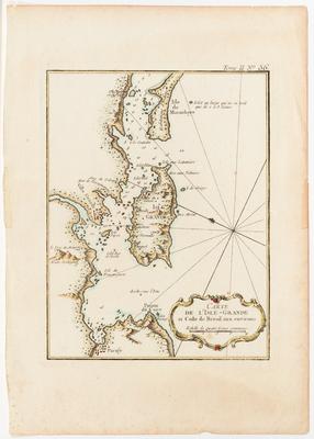
Carte de l'Isle-Grande et Coste de Bresil aux environs
(Título original)
Jacques Nicolas Bellin (Autoria)
Água-forte e aquarela sobre papel
22.5(height) x 16.5(width)(mancha)
32.4(height) x 23.9(width)(suporte)
23.1(height) x 18.5(width)(testemunho)
32.4(height) x 23.9(width)(suporte)
23.1(height) x 18.5(width)(testemunho)
BN Portugal = http://purl.pt/103/1/catalogo-digital/registo/053/053.html
Moreland, Carl & Bannister, David. Antique maps. Third edition. Londres: Phaidon Press Limited, 1989. pg. 136.
Tooley, R.V. Maps and map-makers. 6th edition. London: B.T. Batsford Ltd., [1978].
Moreland, Carl & Bannister, David. Antique maps. Third edition. Londres: Phaidon Press Limited, 1989. pg. 136.
Tooley, R.V. Maps and map-makers. 6th edition. London: B.T. Batsford Ltd., [1978].
This image is in the public domain and can be downloaded freely. Please cite the author's name followed by Acervo Instituto Moreira Salles. IMS is not responsible for any edits or uses that may defame the intellectual property of the image.
Jacques Nicolas Bellin / Coleção Martha e Erico Stickel / Acervo Instituto Moreira Salles